Listing ID #6038219
Company Information
Ask for more detail from the seller
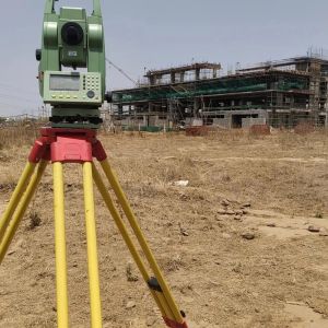
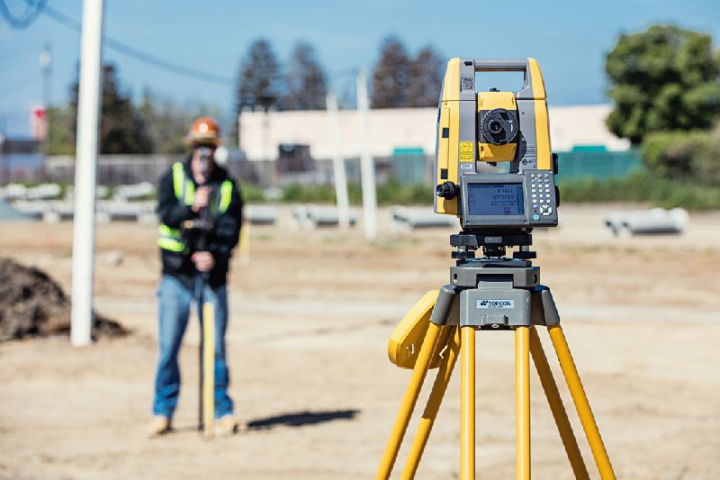
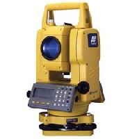
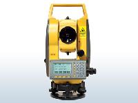
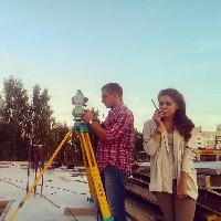
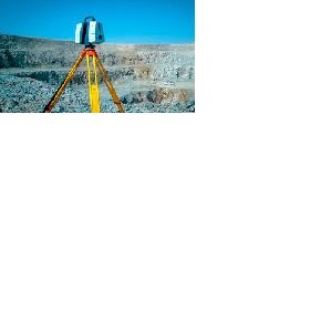
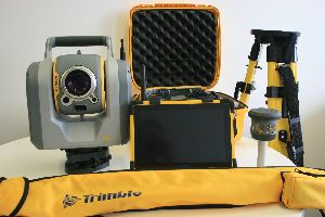
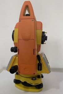
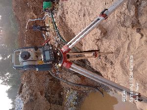
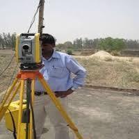
Contact SupplierA Total Station Survey is a precise and advanced land surveying technique that integrates electronic theodolite and distance measuring equipment into a single instrument. This sophisticated device is widely used in various fields, including civil engineering, construction, architecture, and geomatics, to gather accurate spatial data for mapping, design, and construction purposes.
Key features and components of a Total Station Survey include:
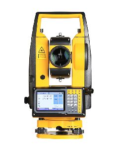
Electronic Theodolite: The total station incorporates a theodolite, an instrument used for measuring horizontal and vertical angles with high accuracy. The theodolite component allows surveyors to precisely measure angles and observe points of interest.
Distance Measurement: Total stations are equipped with electronic distance measurement (EDM) technology, enabling precise and quick measurement of distances between the instrument and a target point. This is commonly achieved using laser or infrared signals.
Automatic Angle and Distance Measurement: The total station automates the measurement process, allowing surveyors to quickly and efficiently gather angle and distance data with minimal manual intervention.
Data Collection: Total stations are often connected to data collectors or computers, facilitating real-time data collection and storage. This data can include coordinates, angles, distances, and additional information relevant to the survey.
Coordinate Calculation: Total stations provide the ability to calculate coordinates by triangulating distances and angles, allowing surveyors to determine the precise location of surveyed points in a designated coordinate system.
Accuracy and Precision: Total stations offer high accuracy and precision, making them suitable for a wide range of applications, including topographic surveys, construction layout, boundary surveys, and monitoring of structural deformations.
Integration with GPS: Some total stations are equipped with GPS capabilities, enabling integration with global navigation satellite systems for enhanced accuracy and geospatial data integration.
Onboard Software: Total stations often feature onboard software that supports various surveying tasks, data processing, and the generation of maps and drawings.
Remote Control: Advanced total stations may include remote control capabilities, allowing surveyors to operate the instrument from a distance, enhancing safety and efficiency, especially in challenging or hazardous terrain.
Versatility: Total stations are versatile tools, capable of handling a variety of surveying tasks, including topographic mapping, construction layout, monitoring, and setting out precise points for infrastructure development.
Total Station Surveys have revolutionized land surveying by providing a comprehensive and efficient solution for collecting accurate spatial data. The integration of measurement, calculation, and data recording capabilities makes total stations indispensable tools in modern surveying practices.
Established in the year 2016, we, Lucknow Land Surveyors, are one of the most reputed organizations engaged in proposing reliable and effective Construction and Engineering Survey Services and we also provide service for coordinate verification. We are the registered agent for AAI height clearance. Our offered services are operative and are performed within the stated period with the help of expert & proficient professionals. To keep their reliability and efficiency, we apply the latest methodologies, equipment and higher quality accessories in rendering these services.
We are on the path of constant success and growth under the leadership of our mentor and guide, Mr Umesh Yadav ', our owner who holds huge experience in this field. His outstanding entrepreneurship and guiding skills have helped us in accomplishing our organizational goals.
The services offered by us are
Land Surveying service
Canal surveying service
Topographic Survey Services
Building surveyor survey service
Electric line survey service
Railway track survey service
Soil testing service
And many more in this category
Our strength
With the support of the latest equipment’s and experienced professionals, we bring these services in a prompt, proficient and streamlined manner. Our offered services are under the client’s necessities and international standards of quality:
Why us?
Providing an extensive range of survey services
Excellent team of experts
Equipped with the latest technology
Experienced in many sectors


Connect with us