Our Product / Services
Industrial Machinery
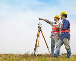
2 Products availableEngineering Survey Services
1 Services availableConstruction Machinery & Equipment
1 Products availableJigs, Casting Dies, Die Casting Moulds & Moulding Tools
1 Products availableOur product range contains a wide range of rail survey, highway survey, Rail Corridor Observation survey services, soil survey and Topographical Survey
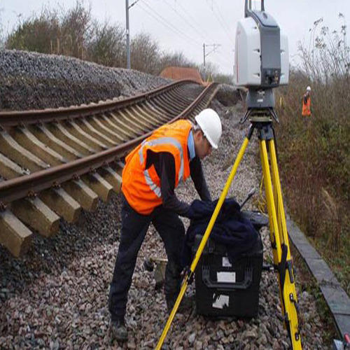
railways throughout the world differ dramatically in size, type of operation and the environment in which they operate, yet all are asset-intensive corridors. Geo adithya asset mapping services provide customers with the information needed to ensure the safe and uninterrupted operation of railway corridors. Recognizing that construction, modification and maintenance of railway corridors add to operating expenses for rail operators, geo adithya has developed a unique combination of technologies to provide cost-effective solutions that assist railway operators in managing their valuable right-of-way assets from city centers to remote rural areas.
geo adithya rail corridor observation and reporting program use leading-edge technology to gather field data during regularly scheduled airborne or rail car surveys. High-resolution digital images and other sensors acquire continuous coverage of the right-of-way, providing updated geo-referenced datasets from every mission. Once processed and compared to previous data, our fast and automated change detection software highlights areas of concern for more detailed analysis, providing our clients with the most recent dataset to maintain the currency of their in-house or web hosted gis.
Additional Information:
Payment Terms : L/C, D/A, T/T, Western Union
Packaging Details : AS PER REQUIREMENT.
Delivery Time : 7 days
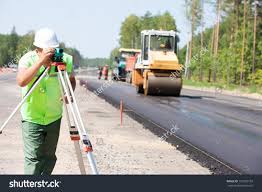
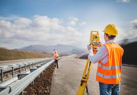
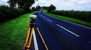
| Highway surveyingis a specialized type of landsurveyinggenerally conducted for government agencies during the planning stages of ahighwaydevelopment project. . Often the goal of thissurveyis to determine the appropriateroutewhere the least amount of land will need to be moved |
Additional Information:
Payment Terms : L/C, D/A, T/T, Western Union
Packaging Details : AS per demand
Delivery Time : 7 days
thesurveysto be carried out are: map study: - with the help of topographic map it is possible to suggest the likely routes of the road. . The main features like rivers, hills, valleys, etc., are also shown on these maps. Reconnaissance: - it is a rapid and roughsurvey.
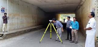
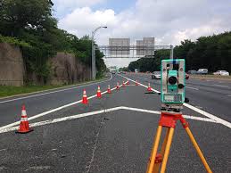
instrument:topographicapplication:total stationusage:find levels
Additional Information:
Payment Terms : L/C, D/A, T/T, Western Union
Packaging Details : As per demand
Delivery Time : 7-10 days

Railways throughout the world differ dramatically in size, type of operation and the environment in which they operate, yet all are asset-intensive corridors. Geo Adithya asset mapping services provide customers with the information needed to ensure the safe and uninterrupted operation of railway corridors. Recognizing that construction, modification and maintenance of railway corridors add to operating expenses for rail operators, Geo AdithyA has developed a unique combination of technologies to provide cost-effective solutions that assist railway operators in managing their valuable right-of-way assets from city centers to remote rural areas.
Geo AdithyA Rail Corridor Observation and Reporting program use leading-edge technology to gather field data during regularly scheduled airborne or rail car surveys. High-resolution digital images and other sensors acquire continuous coverage of the right-of-way, providing updated geo-referenced datasets from every mission. Once processed and compared to previous data, our fast and automated change detection software highlights areas of concern for more detailed analysis, providing our clients with the most recent dataset to maintain the currency of their in-house or web hosted GIS.
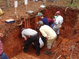
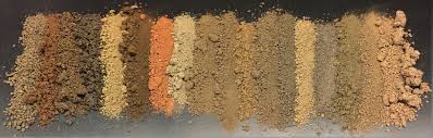
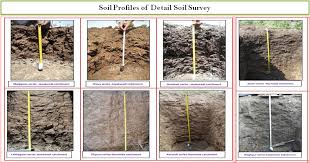
| Soil survey, soil mapping, is the process of classifyingsoil typesand other soil properties in a given area and geo-encoding such information. It applies the principles ofsoil science, and draws heavily fromgeomorphology, theories ofsoil formation, physical geography, and analysis ofvegetationandland usepatterns. Primary data for the soil survey are acquired by field sampling and byremote sensing. Remote sensing principally usesaerial photography, butLiDARand other digital techniques are steadily gaining in popularity. In the past, a soil scientist would take hard-copies of aerial photography, topo-sheets, and mapping keys into the field with them. Today, a growing number of soil scientists bring aruggedized tablet computerandGPSinto the field with them. The tablet may be loaded with digital aerial photos, LiDAR, topography, soil geodatabases, mapping keys, and more. |
Additional Information:
Payment Terms : L/C, D/A, T/T, Western Union
Packaging Details : As per requirement.
Delivery Time : 7 days


Additional Information:
Payment Terms : L/C, D/A, T/T, Western Union
Packaging Details : As per demand
Delivery Time : 7 days