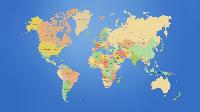
Inox Spatial Data & Services (ISDS) supplies comprehensive map database & location content to publication industry , travel companies, telecom companies, telematics companies (Taxi Dispatch), Internet-based mapping applications, government and business solutions. Inox Spatial Data & Services (ISDS) invested in the creation of high value, off-the-shelf map data products. It has created seamless city, regional, and country databases by combining sources such as paper maps, satellite imagery, aerial photographs, and survey data. Today, Inox Spatial Data & Services (ISDS) is a digitalInox Spatial Data & Services (ISDS) an extensive set of off-the-shelf map data products for countries, regions and cities all over the world. Inox Spatial Data & Services (ISDS) offers updates these country, regional, and city databases with land-use, elevation, and vector images at resolutions of 25m, 50m and 100m. These data products are available in various formats. Inox Spatial Data & Services (ISDS) has a suite of country, state, and city map data products for India containing spatial as well as demographic data.