Related Category


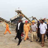


Construction Quantity Surveying Services are integral to efficient project cost management. These professionals meticulously assess and quantify construction materials, labor, and expenses, creating a comprehensive cost breakdown. Offering accurate estimates and budget analysis, Quantity Surveyors play a cruc more...

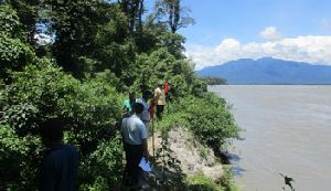


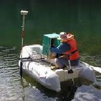
Being a client-focused organization, GeosolutionProservicesPtd. Ltd, offer a unique array of hydrological survey services in Kolkata. Our hydrological survey is a prerequisite required to evaluate the design parameters of industrial, power, irrigation and river valley projects. It is our goal to offer fully-i more...

Our Route Mapping and Surveys Service provides meticulous analysis and planning for optimized transportation routes. Using cutting-edge technology and expertise, we conduct thorough surveys to identify the most efficient paths for your logistics operations. From assessing road conditions to analyzing t more...
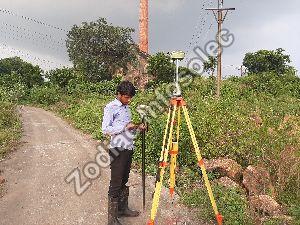
Zodiac Infosolec is the best for DGPS Survey Services in India. This survey is used for the improved location accuracy, in the range of operations of each system, these surveys are constantly correct to the sub-centimetre level. Each DGPS Survey is done using a network of fixed ground-based reference s more...
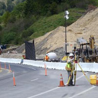
Ours is a premier service provider company, offering professional solutions for field survey needs. We are operating from Rajasthan, India. The assigned work is executed by a team of land surveyors, who make use of elements of geometry & trigonometry to determine terrestrial and 3D positions of points and more...
Get Quotes from Verified Suppliers
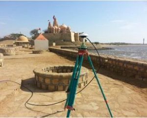
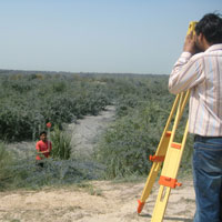
Ideal Geoservices offer topographic survey service offers precise mapping and analysis of terrain for various applications, including urban planning, infrastructure development, and land management. Using cutting-edge surveying technology such as GPS and LiDAR, we capture detailed elevation data, contours, an more...

Elfin India is a fast growing professionally managed company in the field of language localization and customization. Elfin India offers complete solution on Survey Translation Services. We at Elfin India understand the importance of customization that is not only correct but also makes sense and connects wel more...

Optimize your transportation efficiency with our Route Surveys Service. Our experienced team conducts detailed assessments of potential travel routes to identify obstacles, road conditions, and clearance issues. Whether you're transporting oversized cargo, machinery, or planning a special convoy, our surveys more...
Connect with us