Our Services
Architectural Modeling, CAD, CAM Design & Drawing Services
1 Services availableNuts Bolts And Fasteners
1 Services availableNetwork Software
1 Services availableConstruction Services
1 Services availableElectrical & Signaling Contractors
1 Services availableSubsurface utility engineering can reduce unnecessary utility relocations and the likelihood that existing utilities will be damaged by new construction projects.
We are Using Two Methods for SUE
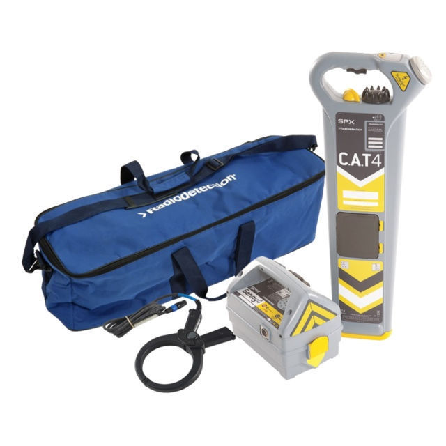
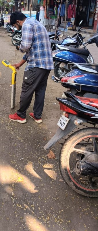
We utilize radio frequencies that are powered through utility lines via a transmitter and can be picked up by an accompanying receiver.
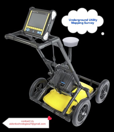
We utilize multiple Ground Penetrating Radars that have different frequencies depending on the application

Subsurface utility engineering (SUE) deals with the mapping of underground utilities such as pipelines and cable lines. Subsurface utility engineering also encompasses retrieving information on the present condition of existing subsurface utilities and when and how to relocate subsurface utilities. Subsurface utility engineering uses geophysics, civil engineering and surveying to complete its tasks.Subsurface utility engineering can reduce unnecessary utility relocations and the likelihood that existing utilities will be damaged by new construction projects.
We are Using Two Methods for SUE

We give a total turn key solution in fiber laying like :

Private utility locating helps us to identify underground utilities in private properties. All utilities that are found will be visually marked with paint, letting all field personnel know that they need to avoid that area. Some of the utilities that are typically discovered and marked include:
gas pipes backup generator lines sewer laterals septic tank pipes irrigation systems storm drains site lighting lines telecommunication lines
Private utility locating services are also useful in facilities like industries, schools, hospitals, apartments, and military installations that are not considered public-owned. These utilities are below the ground and may not be visible, so calling for private utility locating services is the best thing to do.
Performing an excavationbeforelocating private utilities can lead to severe injuries to construction workers. Also, fixing or repairing damaged underground utilities can be expensive and time-consuming. Sometimes the repair may involve trenching or drilling the entire area. If an underground utility is damaged, its up to the project manager on-site to fix it as soon as possible.

GIS (Geographic Information System) Mapping :
A geographic information system (GIS) is a computer system for capturing, storing, checking, and displaying data related to positions on Earths surface. GIS can show many different kinds of data on one map, such as streets, buildings, and roads. This enables people to more easily see, analyse, and understand patterns and relationships.
Benefits Of GIS
1)GIS explores both geographical and thematic components of data in a holistic way
2)GIS allows handling and exploration of large volumes of data
3)GIS allows integration of data from widely disparate sources
4)GIS allows analysis of data to explicitly incorporate location
5) GIS allows wide variety of forms of visualization such as maps, reports, charts etc
6) GIS provides very accurate data
7) GIS provides better predictions and analysis